Wetlands: Definition and importance
Wetlands are located in the area between permanently wet and permanently dry habitats.
Wetlands are located in the area between permanently wet and permanently dry habitats. Depending on their history, geographical location, water regime and chemistry, soil or sediment features, and plant species, wetlands have diverse appearances.
There are five main groups of wetlands:
- Marine systems: Near-shore wetlands, including rocky marine shores and coral reefs
- Estuarine systems (including deltas): tidal marshes and mangrove swamps
- Lake systems: Wetlands around lakes
- River systems: Rivers and brooks, and the associated wetlands
- Marsh systems (i.e. swampy): Fens, bogs and marshes
In addition, there are human-made wetlands: Fish ponds, irrigated land, reservoirs, pebble and gravel pits, canals etc.
The definition of the Ramsar Convention is:
“Wetlands are areas of marsh, fen, peatland or water, whether natural or artificial, permanent or temporary, with water that is static or flowing, fresh, brackish or salt, including areas of marine water the depth of which at low tide does not exceed six metres.”
Importance of wetlands
“There is no life without water. It is a treasure indispensable to all human activity.” (European Water Charter, 1968).
Wetlands have one thing in common: the abundance of water. Type and available volume of water differ. If you think of a lake and a marsh, it is evident that the amount of water available is not the same everywhere.
Wetlands are an important component in the global water cycle. They are characterised by their high ecological importance and house lots of biocommunities. Moreover, these complex and dynamic habitats fulfil important functions that serve man in multiple ways:
Wetlands are drinking water reservoirs, contribute to the preservation of groundwater and the improvement of water quality, store precipitation, are a prerequisite for fishing and the production of important foods, such as rice, enrich the landscape and often serve as recreational areas.
They are particularly important in the event of floods, natural phenomena and disasters. A resolution adopted at the ninth Conference of the Parties (COP9), held in Kampala (Uganda) in 2005, requests member states among other things to conserve and renaturate their Ramsar sites as well as other wetlands and neighbouring biotopes in order to maintain, or restore, their protective function in the event of natural disasters (tsunamis, hurricanes etc.).
The list of wetland functions could be continued. With the conservation of wetlands, the protected asset "water", to which more and more importance is attached worldwide, can be preserved as well. The basis for the ecological functionality of wetlands is an intact water balance.
Wetland conservation is thus closely related to water resource management. If the ecological values and the most important functions of wetlands are to be safeguarded to a sufficient extent, appropriate amounts of water must be available.
Types of wetlands
In order to provide a quick overview of the wetland types existing around the world, an international classification of wetland types was established.
I Marine / Coastal wetlands
A Permanent shallow marine waters
B Marine subtidal aquatic beds
C Coral reefs
D Rocky marine shores
E Sand, shingle or pebbles shores (incl. dunes)
F Estuarine waters (estuaries)
G Intertidal mud, sand or salt flats
H Salt meadows
I Mangrove swamps/Intertidal forested wetlands
J Coastal brackish and saline lagoons
K Coastal freshwater lagoons
Zk(a) Karst and other subterranean hydrological systems
II Inland wetlands
L Permanent inland deltas
M Permanent rivers/streams/creeks; waterfalls
N Seasonal/intermittent/irregular rivers/streams/creeks
O Permanent freshwater lakes (over 8 ha)
P Seasonal/intermittent freshwater lakes (over 8 ha)
Q Permanent saline/brackish/alkaline lakes
R Seasonal/intermittent saline/brackish/alkaline lakes and flats
Sp Permanent saline/brackish/alkaline marshes/pools
Ss Seasonal/intermittent saline/brackish/alkaline marshes/pools
Tp Permanent freshwater marshes/pools
Ts Seasonal/intermittent freshwater marshes/pools on inorganic soils
U Non-forested peatlands
Va Alpine wetlands
Vt Tundra wetlands
W Shrub-dominated wetlands
Xf Freshwater, tree-dominated wetlands
Xp Forested peatlands
Y Freshwater springs; oases
Zg Geothermal wetlands
Zk(b) Karst and other subterranean hydrological systems
III Human-made wetlands
1 Fish and shrimp ponds (aquaculture)
2 Farm ponds and small tanks
3 Irrigated land (incl. irrigation channels and rice fields)
4 Seasonally flooded agricultural land
5 Salt exploitation sites
6 Water storage areas, reservoirs
7 Excavations (e.g. sand and gravel pits)
8 Wastewater treatment areas
9 Canals and drainage channels
Zk(c) Karst and other subterranean hydrological systems, man-made
Selected habitats
Wetlands are sources of biodiversity at all levels. In order to provide a small insight into the different habitats, some of them are described below.
Mires
Austria has a large number of mires of international and national importance. Some of these mires have also been designated Ramsar sites, for example Hörfeld Moor, Sablatnig Moor, Pürgschachen Moor, mires on Nassköhr, Überling and Schwarzenberg as well as mires on Pass Thurn.
The classification of mires as fen (“Niedermoor”) and raised bog (“Hochmoore”) indicates the type of the available water.
“Niedermoore” (fens) are often referred to as “Flachmoore”, in Alemannic German also as “Riede”. They are fed by the groundwater. Fens are rich in nutrients. For this reason, peat mosses cannot prevail against the competition of other moisture-loving plant species and make the transition to raised bogs. This habitat is characterised by high diversity of species and density of individuals.
In raised bogs, which contain clock-shaped arched peat bodies, water supply is exclusively by rainwater. They are linked to areas with high precipitation. The characteristic feature of raised bogs is their low level of nutrients. Plant species occurring there are “hunger artists”. For example, “carnivorous” plants, like round-leaved sundew and butterwort, cover their nitrogen demand from the protein of small insects, which they catch and digest with the help of sticky glandular secretions. Many species are highly specialised. They are unable to grow in any other location.
Transitional mires take a place in between the two because they are fed partly by rainwater, partly by mineral soil water. In Austria, mires occur in all Federal Provinces. A large number of mires can be found in the Provinces of Carinthia, Salzburg, Styria, and Vorarlberg. An area particularly rich in mires is the Tamsweg region in the Province of Salzburg. The area is one of Austria’s most marshy natural environments.
Riparian forests and cars
Riparian forests rank among the large-scale wetlands of Central Europe. They are regularly flooded forest areas within the sphere of influence of the groundwater. The high vitality and lushness of riparian forests, which is due to the good supply with water and the high air humidity, evokes the character of tropical primary forests.
The stagnant water bodies that developed in the area of riparian forests due to the dynamics of the river, like for example oxbow lakes and dead stream branches, are jointly referred to as “floodplain waters”. They include also the river beds artificially separated in the course of river regulations (“Ausstände”) as well as all small stagnant water bodies caused by groundwater and precipitation water.
Floodplain waters are an important ecological component of alluvial floodplains. The enormous biodiversity of riparian forests is based on the coexistence and the close interlocking of river, standing and slowly flowing waters, floodplain meadows, reed beds, sand spits and dry locations.
In Austria, large floodplains have survived only in the basins of the Danube and along free stretches, for example on March, Thaya and Leitha. The floodplains east of Vienna, on the March river and in the Lower Lobau have also been designated Ramsar sites. In the Alpenvorland, floodplains can be found along the Salzach, Mur and Traun rivers, otherwise only in small isolated places.
Contrary to floodplains, carrs always occur on constantly wet soils. Therefore, they can often be found in the silting areas of lakes and ponds. Black alder copes best with these “wet” sites.
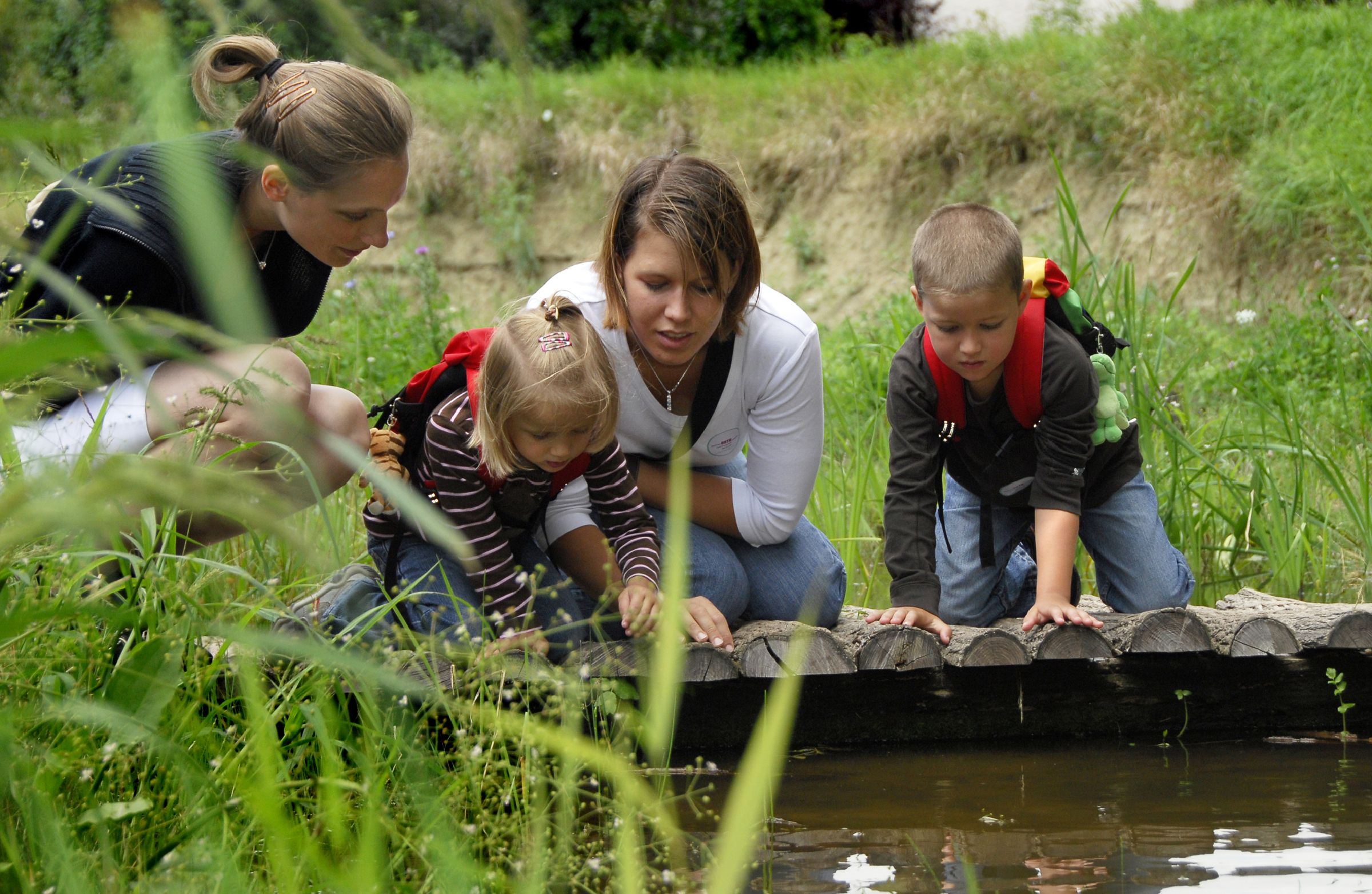
Running waters
Rivers and brooks are the lifelines of our landscape. They link the ecosystems of land and water. As water bridges flowing on the surface, they connect springs and seas via the natural gradient.
Hydraulic and power plant construction, regulations and hard river-bank constructions have led to the fact that near-natural running waters are rare in Central Europe. For example, gravel corridors in the river bed have been massively reduced through impoundments and profound river construction measures.
Austria has about 100,000 kilometres of running waters. The Danube River, the second-longest and most water-rich river in Europe, has a river length of 350 km in Austria. Two studies of the Vienna University of Natural Resources and Life Sciences prove that of around 5,000 km of river stretches examined (except for the Danube) only 21 percent are still close to nature. Many rivers are dissected into small pieces, the majority of them are located in the high upper reaches of rivers.
The section of the Lafnitz river on the provincial border between Burgenland and Styria was designated as a Ramsar site because it is one of the last near-natural lowland rivers in Austria.
Within the framework of the “Living Rivers” campaign conducted by the (former) Ministry of Life and WWF Austria, 74 river stretches of Austria-wide importance were selected. These rivers are guidelines for nature conservation and for future protective hydraulic engineering and therefore must be protected against any deterioration.
In 2002 and 2003 the action plan "Living Rivers II" was worked out, which in addition to the Directorates of Water Management and Nature Conservation of the (former) Federal Ministry of Agriculture, Forestry, Environment and Water Management (BMLFUW) and WWF Österreich also integrated the Service for Torrent and Avalanche Control.
Marshes
Marshes (wetland meadows) offer habitats for herbaceous plant communities of humid to very wet soils. They occur for example along the rims of mires or in floodplain areas. The humid soil can be due to a high groundwater level or to surface water. The composition of the plant communities of the meadows varies depending on nutrient content, calcium content and altitude as well as on the type and duration of wetting. Furthermore, the type of utilisation is decisive for the plant cover.
However, many meadows have only developed through human utilisation, which prevented the development of trees and shrubs.
For example, litter meadows (“Streuwiesen”) were mown only once per year, in late autumn. The term is derived from the fact that the strawy cuttings were mainly used as litter in barns. Litter meadows are characterised by an extraordinary species richness. Litter meadows are home to many different orchids, primroses and gentians. However, the typical plant species of litter meadows is the moor grass
Extensively used marshes/wet(land) meadows, so-called “acidic” meadows, are a paradise for some animal species, for example for butterflies and grasshoppers. On wetland meadows located close to waters, dragonflies and amphibians are common. They represent the most important habitat for meadow breeders, for example for peewit and for Eurasian curlew (Numenius arquata) and corn crake, which are threatened with extinction. In Austria, large litter meadows can be found in the Rhine Valley (Vorarlberg). In the Rhine Valley, one of the first Austrian Ramsar sites was designated as early as in 1983.
Fish ponds
Fish ponds are small waters established for fish breeding. Depending on the type of water available, a distinction is made between source, river and “sky” ponds. The latter are fed only by rainwater. All ponds have a draining device and, if still used, are drained once every year or every other year. In most cases, ponds are drained in autumn. Underwater vegetation can therefore develop only sparsely. By draining and leaving the pond bottom, rare plants which otherwise hardly find suitable habitats can settle on the open mud bottoms. Fish ponds could therefore serve as compensation areas for species whose original habitats disappeared or are disappearing.
Fish ponds having structured shore zones are excellent waterfowl habitats in addition to ponds considered tended in terms of pond (fish) farming. For ponds which are not completely stocked, i.e. not completely filled with water, offer wildfowl ideal conditions for foraging.
Many of Austria’s ponds were established in the Middle Ages already. A particularly large number of ponds were established in the Waldviertel region, in Styria and Tyrol. The Waldviertel ponds are among the Important Bird Areas in Austria.