Austria’s Ramsar sites at a glance
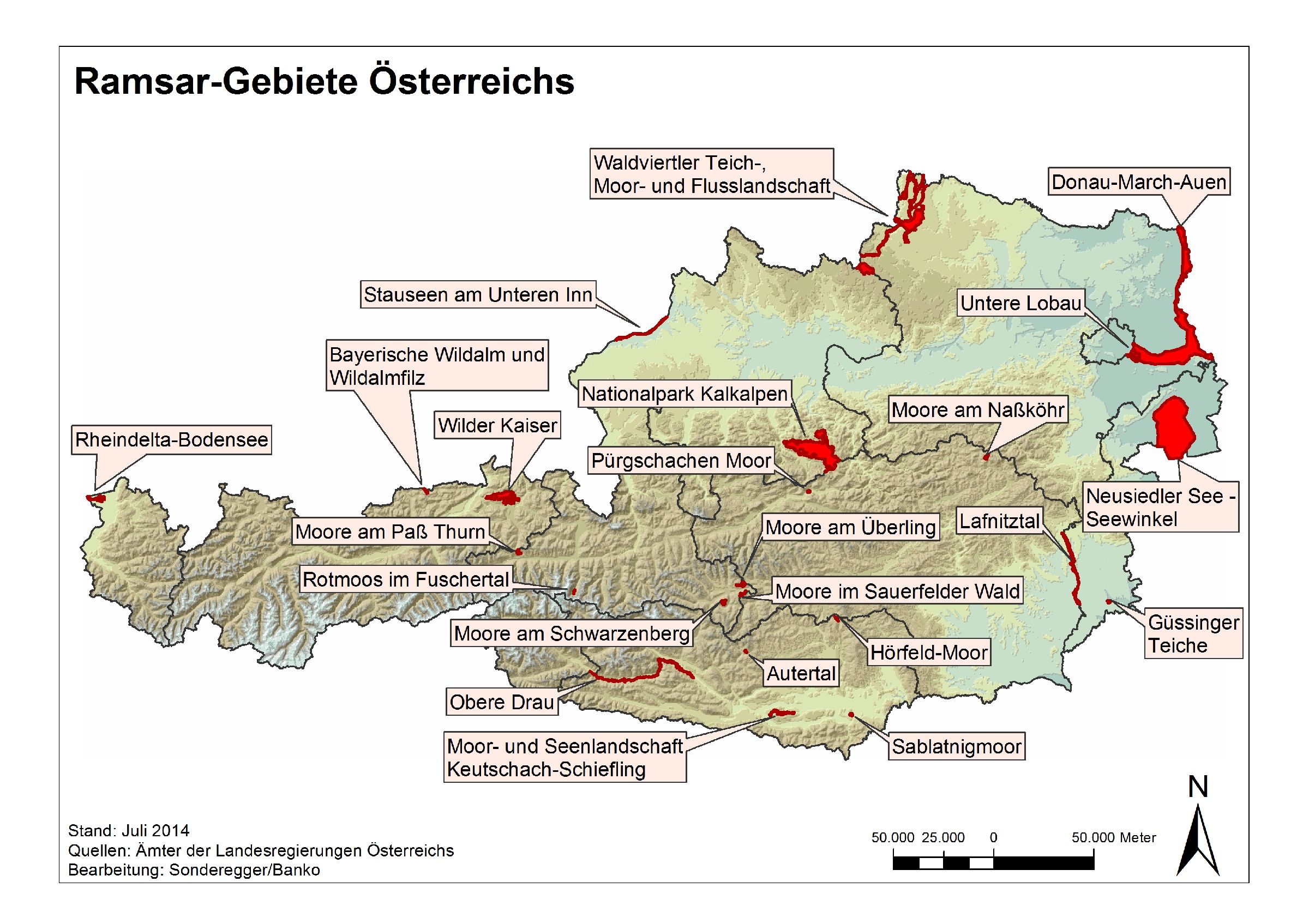
Rivers and brooks, bogs, lakes and marshes (wet meadows). The diversity of wetland habitats is part of the Austrian identity and uniqueness. 24 Austrian areas have been designated as Ramsar sites.
The areas included in the list of wetlands of international importance meet criteria relating to their ecological, botanical, zoological, limnological and hydrological value. The following table provides an overview of Austria’s Ramsar Sites.
| Number | Ramsar Site | Federal Province | Ramsar Site since | Area in ha |
| 1 | Lake Neusiedl - Seewinkel | Burgenland | 1983 | 60,000 |
| 2 | Donau-March-Thaya-Auen | Lower Austria | 1983 | 38,500 |
| 3 | Lower Inn Reservoirs | Upper Austria | 1983 | 870 |
| 4 | Lower Lobau | Vienna | 1983 | 915 |
| 5 | Rhine Delta, Lake Constance | Vorarlberg | 1983 | 1,960 |
| 6 | Pürgschachen Mire | Styria | 1991 | 62 |
| 7 | Sablatnig Mire | Carinthia | 1992 | 96 |
| 8 | Hörfeld Mire | Carinthia/Styria | 1996 | 120 |
| 9 | Rotmoos in the Fuscher Valley | Salzburg | 1995 | 58 |
| 10 | Pond, bog and river landscapes in the Waldviertel | Lower Austria | 1992 | 13,000 |
| 11 | Lafnitz Valley | Burgenland/Styria | 2002 | 2,180 |
| 12 | Nationalpark Kalkalpen (National Park Limestone Alps) | Upper Austria | 2004 | 18,532 |
| 13 | Mires of the Pass Thurn | Salzburg | 2003 | 190 |
| 14 | Mires of the Sauerfelder Forest | Salzburg | 2004 | 119 |
| 15 | Mires of the Schwarzenberg | Salzburg | 2004 | 266 |
| 16 | Mires of the Überling | Salzburg | 2004 | 264 |
| 17 | Mires of the Nassköhr | Styria | 2004 | 211 |
| 18 | Mires and lakes of Keutschach-Schiefling | Carinthia | 2005 | 543 |
| 19 | Mires of the Bayrische Wildalm and Wildalmfilz | Tyrol | 2005 | 132 |
| 20 | Autertal (St. Lorenzen Raised Bog) | Carinthia | 2011 | 48 |
| 21 | Ponds of Güssing | Burgenland | 2013 | 148 |
| 22 | Wilder Kaiser | Tyrol | 2013 | 3,781 |
| 23 | Upper Dravy River | Carinthia | 2014 | 1.0330 |
| 24 |
Lendspitz Maiernigg moorland, marsh forest and lake landscape |
Carinthia | 2023 | 78 |
Table 1: Austria’s Ramsar Sites