Land-use planning

Forest land-use planning reflects the diverse landscape in Austria.
Forest Development Plan (FDP)
The Forest Development Plan was drafted by experts and contains recommendations on the functions of the entire Austrian forest based on the Forest Law. It is a superordinate strategy to assess the forest conditions on a federal level, identify the key functions of forests and to help maintain all forest functions for the long term through future-oriented planning. All policies required to achieve these goals have to be marked and ranked according to their levels of urgency; appropriate actions to implement them will then be launched based on this ranking. The Forest Development Plan is an important basis for political and legal decisions of relevance to forestry.
Hazard Zone Plan
The Hazard Zone Plan, which aims at mitigating the effects of floods and avalanches, is given to all Austrian municipalities that include flood-, avalanche- and/or erosion-prone areas. The Hazard Zone Plan is an area-based survey, which contains recommendations from experts that serve as a basis for spatial planning as well as for projects from both the construction and security sectors.
This was emphasised following the floods of 2002, which highlighted how important it is to consider risk-prone areas in land-use planning.
Content of the Hazard Zone Plan
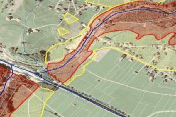
After detailed examinations in the catchment areas, coupled with an evaluation of earlier results, the areas most at risk from hazards such as floods and avalanches have been identified. This then forms the basis of the land-use plan. Based on the year-long experience of the persons working in this field the risk level of the individual plots of land is illustrated by means of the distinction between Red and Yellow Hazard Zones.
The Red Hazard Zone comprises the areas which are so severely endangered by floods or avalanches that their permanent use for settlement and transport is not possible, or possible only at disproportionately high expenditure, since property and infrastructure will be severely damaged by the hazard events outlined above. The construction of new buildings is therefore absolutely prohibited in Red Hazard Zones.
The Yellow Hazard Zone comprises all other flood or avalanche prone areas whose permanent use for settlement or transport purposes is impaired due to this risk.
Technical Forestry Plan
The Technical Forestry Plan is a useful guide for forest planning. Its application permits promising cooperations in forest Management.
This plan has been prepared on the one hand to deal with key issues facing forests, for instance the strengthening of individual responsibility or the motivation of forest owners and, on the other hand, to cope with the increasing challenges which forestry is confronted with due to the emergence of "horizontal issues" such as nature conservation, and the preservation of biodiversity, water resources, cultural aspects and tourism.